|
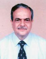
Ranganath Navalgund |
|
|
|

Time:
Monday,31 March, 2014
1140 - 1205
History of Remote sensing Systems at ISRO |
Ranganath Navalgund has a PhD in Physics and worked at the Indian Space Research Organization for a period of 35 years(1977-2012). He held the position of Director of two major Centres of ISRO viz. the Space Applications Centre, ISRO, Ahmedabad(July 2005 to March 2012) and the National Remote Sensing Agency, Hyderabad (May 2001 to November 2005) during this period. His contributions are broadly in the area of Earth Observation Systems, Science and Applications.
He was the President of ISPRS (International Society for Photogrammetry and Remote Sensing) Technical Commission VII during 2000-2004. He has been the Principal Member of GEO (Group on Earth Observation), Academician of the International Academy of Astronautics, Member, of the International Ocean Colour Coordinating Group (IOCCG) and Analysis Group of CEOS. He has led the Indian delegation in the Joint Working Group for Indo-US Civil Space Cooperation, ISRO-Chinese National Space Agency Working Group, ISRO-CNES Megha Tropique and SARAL Science Working Groups and ISRO-ESA Working Group on Earth Observation.
He is currently Vikram Sarabhai Distinguished Professor at ISRO since May 2012.
|
| |
|
| |
Abstract |
| |
A beginning made in 1970 with the experiment on detection of coconut root-wilt disease from a helicopter- mounted multispectral camera system, Indian Remote Sensing Programme has matured into a fully self-reliant operational programme during the last four decades. From the experimental Bhaskara-1 satellite launched in 1979 to the recently launched SARAL, earth observation capability has grown manifold. The Enhancement in observation capability is not only in spatial, spectral and radiometric resolutions but also in their coverage and value added products. The sensors built and successfully flown over this period include state-of-the-art electro optical sensors operating in visible, infrared, thermal infrared region specifically designed to meet various application needs. Microwave sensors flown include a multichannel radiometer, Ku-band scatterometer, an altimeter and a C-band synthetic aperture radiometer. Earth observation data has been extensively used in inventories, monitoring and conservation plans of natural resources of the country for societal benefits. An institutional mechanism for the absorption of technology at different levels of governance has been built through the concept of National Natural Resources Management System. Collaboration with different space agencies in joint missions and active participation in multi-lateral earth observation forums has facilitated Indian Remote Sensing Programme to play supplementary and complementary role at the global level. The presentation attempts to briefly describe this unique evolution.
|